
Ivinghoe Beacon and Ashridge Estate, Hertfordshire
A country walk to Ivinghoe Beacon and Ashridge Estate
Lying to the northwest of London, the Chiltern Hills are an easy escape from the city. This circular walk is mostly within the 5,000-acre Ashridge Estate and takes in some splendid Chiltern scenery, from open downland and flower-filled meadows to ancient woods of beech and ash, plus a picture-perfect village towards the end. The woodlands hereabouts have fantastic displays of bluebells in spring, and there's also a great sense of history here: the Ridgeway trail that you'll follow along the flank of the chalk escarpment been trodden since as long ago as the Iron Age.
Start/end point: Tring, Hertfordshire (45 minutes from London by train)
Distance: 9 miles, 3-5 hours
When to go: all year, though the forest footpaths of the Ashridge Estate can become very muddy in winter
Difficulty: The first part to Ivinghoe Beacon is easy to follow, albeit over numerous hills. The second part through Ashridge is a little trickier to negotiate, so keep your wits about you in the woods
See the map for this walk here: https://www.outdooractive.com/en/route/hiking-route/wkndr-ivinghoe-beacon-and-ashridge-estate/204226190/
You’ll need to create an outdooractive profile to view the route, then hit ‘Open in App’ on your mobile phone to follow the route using GPS.


Directions: Leave Tring station via the car park exit. On reaching the road, turn immediately right through a gate (signposted Hertfordshire Way) and follow the path that parallels the road. Where the hedgerow ends, cross the road and head up a paved drive signposted Ridgeway and Ivinghoe Beacon. Where this crosses another path, turn left and follow the Ridgeway as it proceeds through a lightly wooded area of hawthorn, beech and ash.
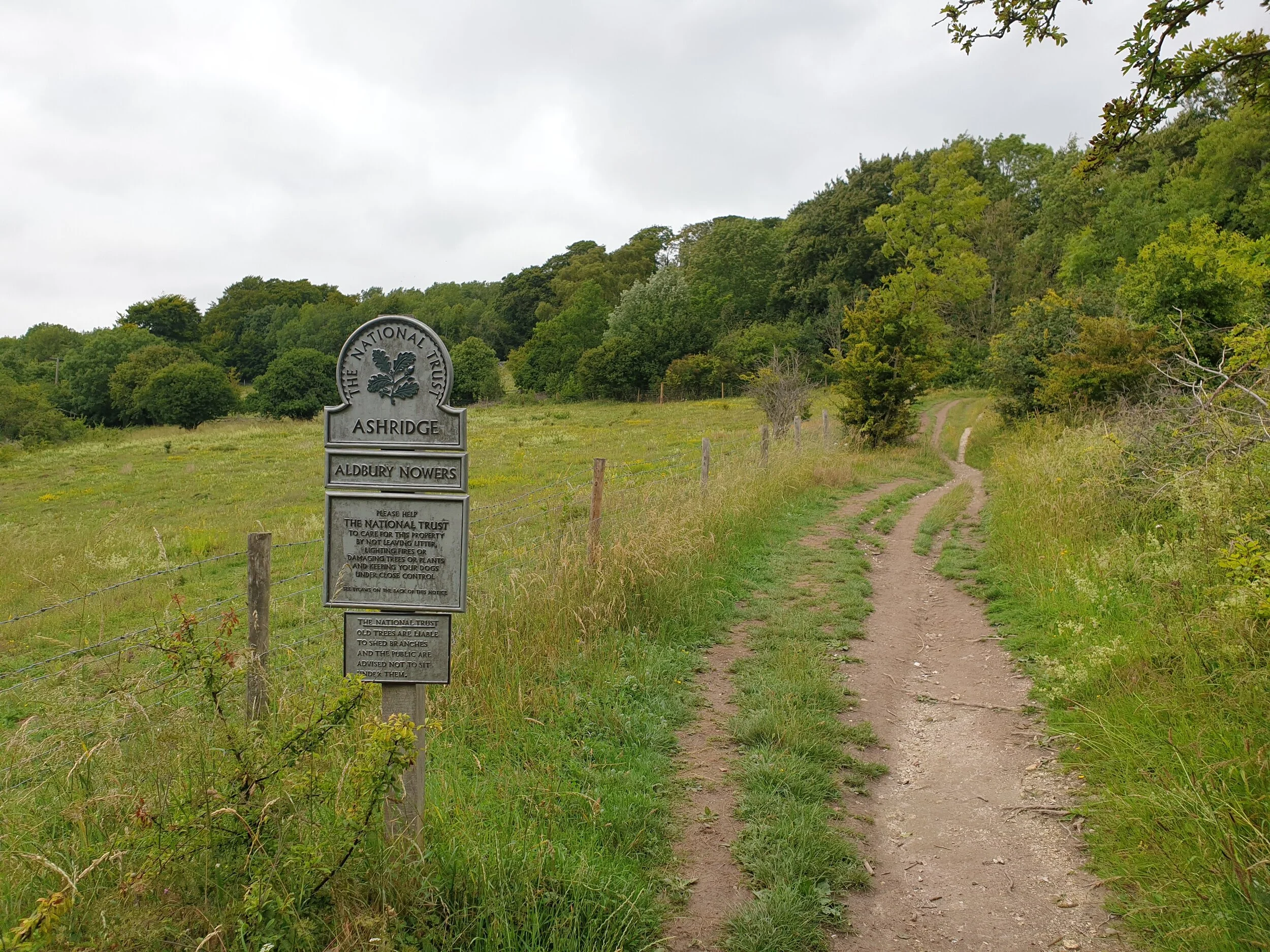
At the next crossroads, follow the Ridgeway to the right into Aldbury Nowers, a nature reserve within the National Trust's Ashridge Estate. Its grassy expanses provide a habitat for 30-odd butterfly species as well as marjoram, hawkbit, scabius and other downland plants. Proceed uphill and veer left (still clearly marked as the Ridgeway) up steps carved into the hillside. Bear left again and the path offers up a lovely view across meadows and fields before plunging once again into a woodland.
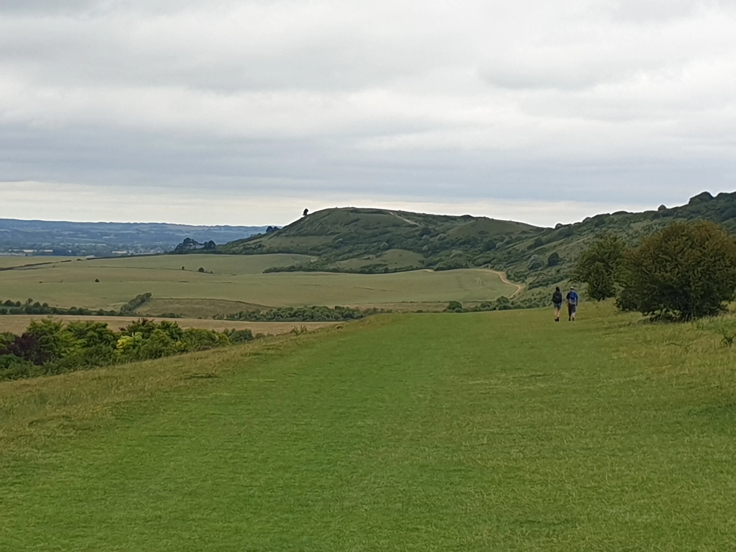
Beyond these beechwoods, the path bursts out onto open, windswept downland. Keep going straight along the Ridgeway to where the ground levels out, with views to both right and left. Ahead, rising proud of the landscape, is Ivinghoe Beacon: a great chunk of chalk that marks the furthest point of this walk.
Carry on through open grassland that's alive with wildflowers in season - carpets of cowslips in spring, or orchids and knapweed later in summer. The farmland through which you're walking is managed in a way that's sensitive to wildlife, so expect to hear plenty of birdsong from the likes of skylarks and yellowhammers, and keep eyes to the skies for red kites. These medium-sized birds of prey thrive in the Chilterns, so watch for them gliding overhead with forked tails constantly twisting.
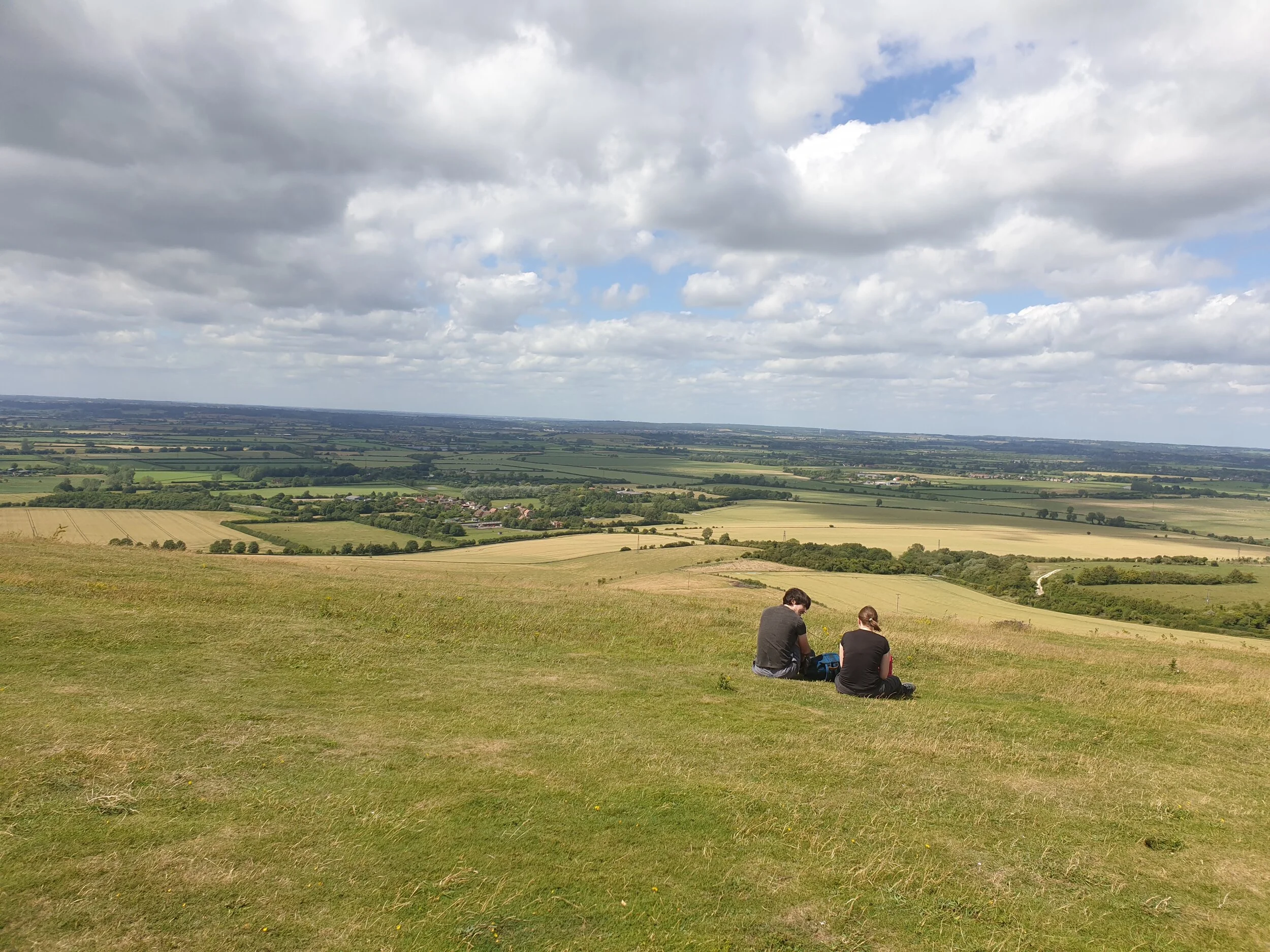
Ahead, the footpath rises again and sweeps around a steep escarpment. At the top, go through the gate and pass though a patch of scrubby woodland before reconnecting with the view. Keep going straight until the path crosses a lane and then rises again to Ivinghoe Beacon. This elevated vantage point was so valued in ancient times that it was used as a hill fort, providing its occupants with edge-of-the-world views across the low-lying Vale of Aylesbury. Pause to take it all in, then continue along the ridge to the right, noting the outline of a lion carved into the gleaming white chalk of the hillside ahead.
Where the path dips downhill, turn right before the gate and follow the fence to the valley floor, then take the next path on the right across an arable field. At its far end, pass through a kissing gate and, avoiding the obvious path uphill, bear left and follow the hedge to reach a gate that leads into a wood. Stay on the well-trodden trail and follow it (marked Icknield Way) into a dark and moody cedar plantation. Where this opens back into natural woodland, follow the path up a steep set of steps and cut straight through the farmyard at the top of the hill.
Carry on through a series of hedge-lined pastures and pass between two blocks of woodland that in springtime are a glorious blaze of bluebells. Keep going straight until the path eventually veers sharp right. Pass a cottage and follow its drive to a lane. Cross the lane and continue on the footpath ahead into the woods, following signs for Public Footpath and Ashridge Estate Boundary Trail.
At a crossroads, leave the Public Footpath and switch to the bridleway dead ahead, marked Visitor Centre & Monument. (These woods are a confusing maze of criss-crossing paths and trails, but don't be too worried if you happen to get lost: it won't be for long. There are plenty of alternative routes to the Visitor Centre, with signage throughout the forest.) The bridleway eventually ends at a broad, cinder track. Turn left and follow it to the Bridgewater Monument, a towering stone column. The visitor centre (with toilets, gift shop and café) lies across grassy clearing. Stop if you fancy, otherwise keep this to your left and descend down the stony bridleway, opting for the more obvious downhill option at each fork.
At the bottom is the chocolate-box-pretty village of Aldbury (one of Hertfordshire's prettiest), whose excellent Greyhound Inn overlooks the village pond. Find a table inside or out and graze on small plates (calamari, farmhouse paté) or proper pub grub such as ham, egg and chips, sausage and mash or a decent Sunday roast.
When you're ready, walk up Station Road past the churchyard to a footpath on the right. Take this through a paddock and on through a gate by the farmyard. At the junction with another path, turn left and follow this back to the starting point, turning right at the road to return to Tring station - and a well-earned nap on the train.
Start planning your journey with www.thetrainline.com