
NEw River walk, North London
A CITY WALK ALONG THE NEW RIVER, NORTH LONDON
From its spring-fed sources in Hertfordshire to its terminus at Sadler's Wells, the New River has one key mission: to keep Londoners hydrated. This purpose-built aqueduct was completed in 1613 and, while it no longer reaches Clerkenwell, it still supplies something like 10% of London's drinking water. The section below Stoke Newington was buried in the 1800s, but its course can still be followed for much of the way. This walk picks up the river where it cuts across Finsbury Park and tracks its route through Stoke Newington and beyond via Clissold Park to Islington.
Starting point: Finsbury Park, N4
Last hurrah: Angel, N1
Distance: 5 miles, 2½-4 hours
When to go: all year
Difficulty: The route is pretty well signposted and you can't get lost on the riverside stretches, though the bit between Green Lanes and Seven Sisters Road can get really muddy in winter.
See the map for this walk here: https://www.outdooractive.com/en/route/hiking-route/wkndr-new-river-walk/205215400/
You’ll need to create an outdooractive profile to view the route, then hit ‘Open in App’ on your mobile phone to follow the route using GPS.


Directions: From Finsbury Park station's main exit, turn left and cross Stroud Green Road into the green space of Finsbury Park. Bear left on the path that skirts the perimeter: you're now on the Capital Ring, the long-distance footpath that loops around London via many of its open spaces. Where this path ends, turn right (signposted Stoke Newington) and pass the café (with handy toilets for a pre-walk wee). The path carries on into McKenzie Gardens, whose flowerbeds have been restored to their original Victorian layout. Stay on the Capital Ring (signposted Clissold Park and New River) as it descends to exit the park onto Green Lanes. Cross the road and bear slightly left to join the New River waterway.
When the New River was created, this whole area would have been fields and woods that fell within the enormous manor of Hornsey. As you follow the watercourse, you'll most likely note its clarity; it's typical of water that's been purified by flowing though natural chalk. Back in the day, this clear, clean springwater was very much needed by the growing city, whose residents otherwise relied on the Thames for their water supply. So huge was the undertaking of constructing the watercourse that it almost bankrupted Sir Hugh Myddleton, the man behind the scheme. Only the input of James I, the reigning monarch, saw sufficient funds made available to complete this feat of engineering.
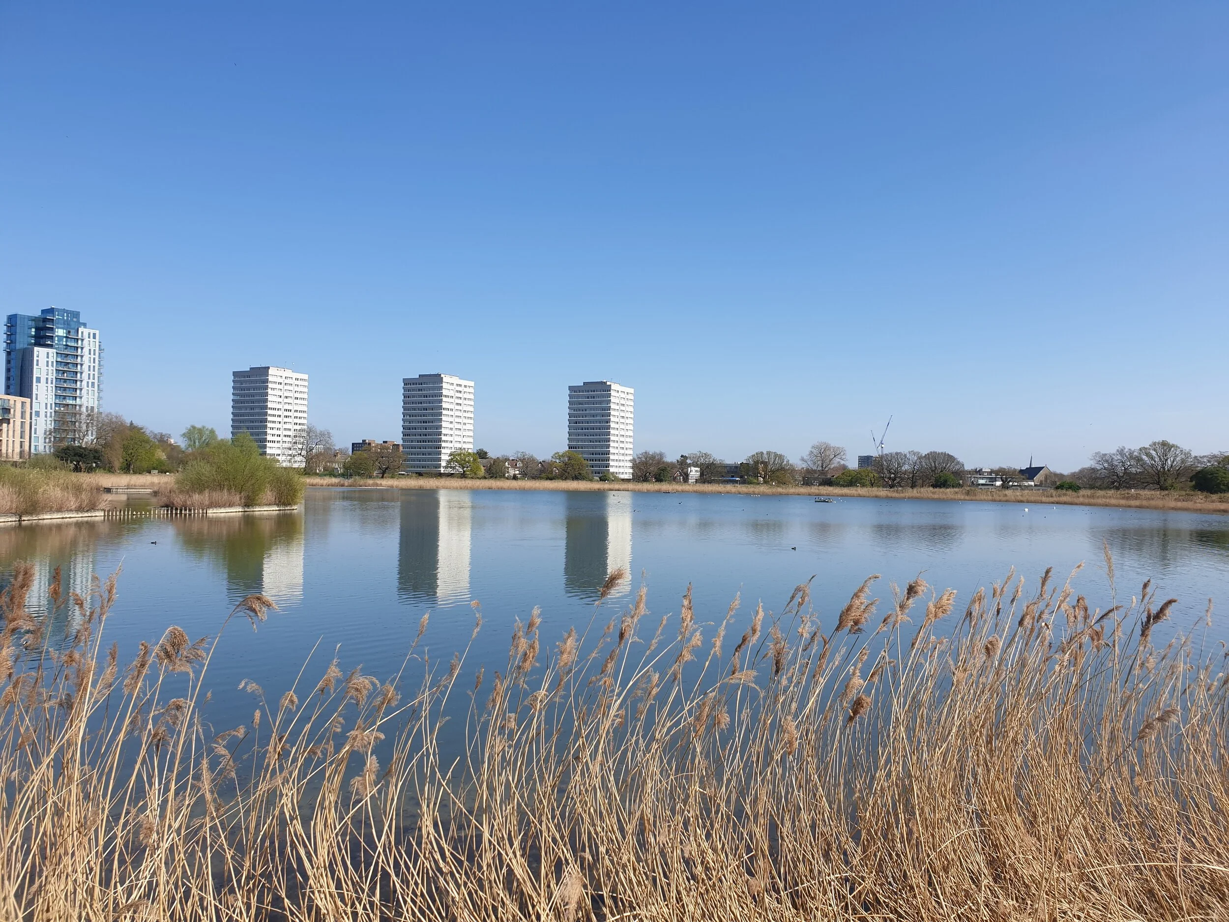
Follow the watercourse as it winds its way to Seven Sisters Road, whereupon cross over and rejoin the path. Where it loops to the right, a view opens up on the left across Stoke Newington's twin reservoirs. The first of these is Woodberry Wetlands, a nature reserve run by the London Wildlife Trust. Take a detour here to check out the birdlife - from summertime warblers to wintering wildfowl - and stop in for a coffee at the excellent on-site café.
Carry on from here past the West Reservoir (home to a water-sports and swimming centre) until the path comes to an end beside a small weir. As you cross the bridge and exit back onto Green Lanes, say goodbye to the New River: from here on, the watercourse was long ago replaced with pipes and its channel filled in. Its memory lives on in the form of the castle on the corner, which was built in the 1850s as a pumping station (it's now used for indoor climbing).
If you've had enough, there's the option of turning right to Manor House station (for a total walk of about 3½ miles). Otherwise, turn left along Green Lanes and continue to Clissold Park. Enter the park and keep going straight, staying parallel with Green Lanes until you exit again at the far corner. Across the road is Clissold Park Tavern, which makes a handy pit-stop for a pee and/or a pint (or even a pizza, best enjoyed on sunny days in the popular beer garden). Then continue down Green Lanes and turn right onto Petherton Road, whose central green strip - Petherton Green - charts the course of the former New River.
Where the park ends, cross Grosvenor Road and pass Canonbury Overground station, then cross St Paul's Road to reconnect with the linear parkland of New River Walk. The watercourse here has been resurrected as an ornamental feature that provides a home for ducks and moorhens (plus a population of terrapins). The quiet, leafy Canonbury backstreets that the parkland passes are lovely: certainly nice enough to merit pausing for a pint at the Marquess Tavern. After this, the landscaped waterway ends at Canonbury Road. Cross this and follow the final green corridor to its end point at the red-brick library. You're suddenly back in the buzz and bustle of London on Essex Road.
Keep going to where Essex Road meets Upper Street at the corner of Islington Green, then take a look at the statue of the man gazing towards Angel. The pantaloons that he's wearing are a giveaway as to his age: this is Sir Hugh Myddleton, for whom the New River is a lasting legacy. He's here because the waterway ended close by at New River Head, next to Sadler's Wells (from where the clean, fresh drinking water was pumped down to the City of London). There's not much New River heritage to perceive beyond this point, so shimmy off to the left for an end-of-walk coffee and cake on Camden Passage. From here, it's a stone's throw to Angel tube, the end point of this journey through 400 years of history and a surprising amount of greenery - all without the inconvenience of leaving Zone 2.