
Arun Valley: Pulborough to Amberley, West Sussex
A country walk through the Arun Valley: Pulborough to Amberley, West Sussex
There's stacks of history along the glorious Arun Valley. This linear, station-to-station walk takes in a World War 2 gun emplacement, medieval stone bridges, thatched cottages and centuries-old castle battlements, plus two lovely pubs serving local-brewed beers. The route criss-crosses the river as it flows through the South Downs National Park, with the Downs' steep, north-facing flank guiding the way. Much of the walking is along the river's floodplain, which is flat but can be boggy: you'll be glad you wore waterproof boots when you hit the soggiest of sections.
Starting point: Pulborough, West Sussex (an hour and a quarter from London by train)
Last hurrah: Amberley, West Sussex
Distance: 9 miles, 4-6 hours
When to go: spring, summer and autumn are best: the valley can flood in particularly wet winters. Waterproof boots recommended.
Difficulty: The route is challenging in parts, especially the path across Amberley Wildbrooks: it's boggy at the best of times and almost impassable when water levels are high. Note that there are two A-road crossings, though they're both single lane and carry reasonably light traffic.
See the map for this walk here: https://www.outdooractive.com/en/route/hiking-route/wkndr-pulborough-to-amberley/204166716/
You’ll need to create an outdooractive profile to view the route, then hit ‘Open in App’ on your mobile phone to follow the route using GPS.


Directions: Starting at Pulborough Station, exit through the car park and pick up the public footpath to the left of the bike shelter. Follow this as it parallels the railway and then crosses it via a bridge. Stay on the lane ahead until it bears right, whereupon take the public footpath into the field on the left.
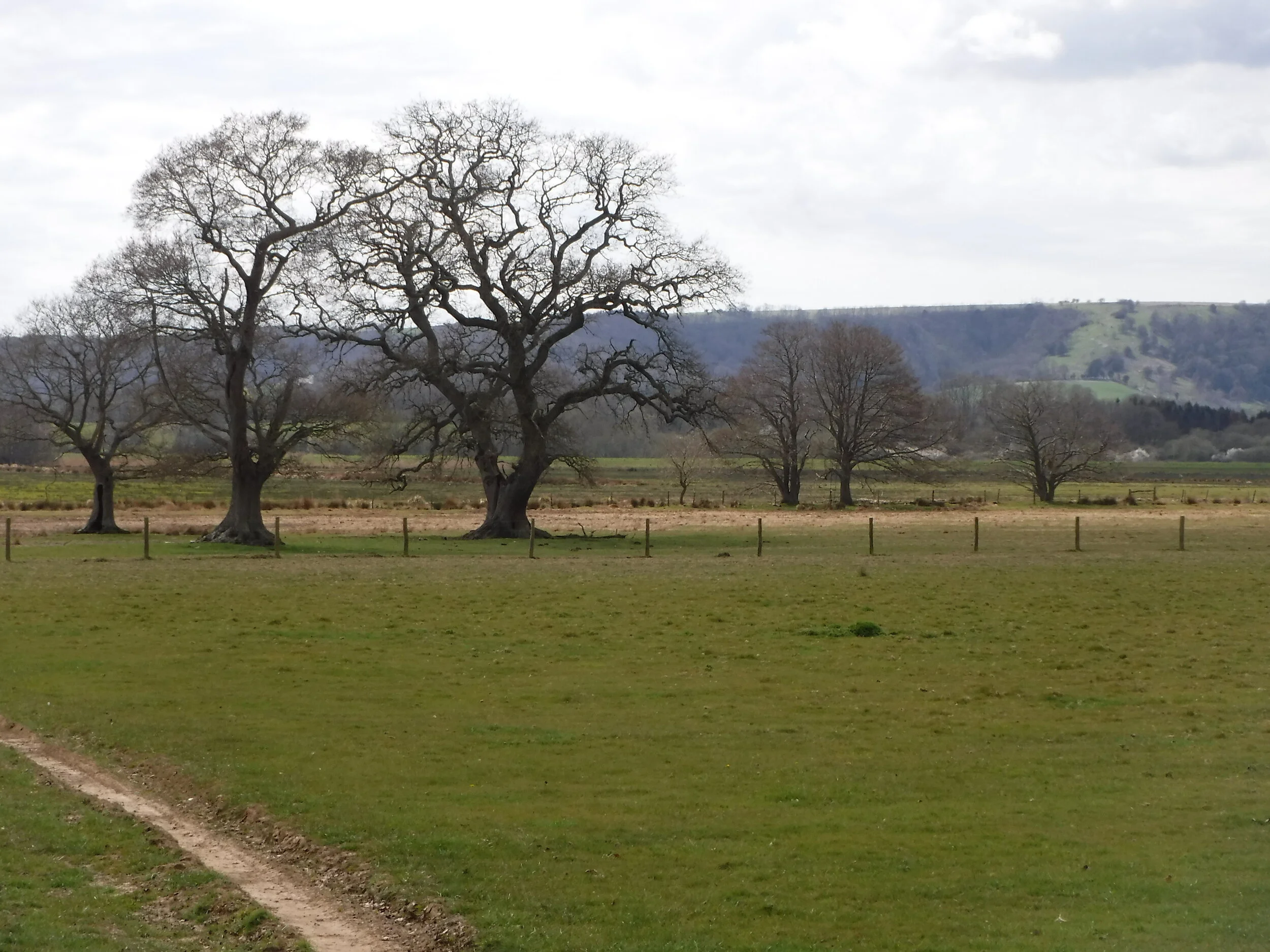
At the top of the rise ahead, note the squat, concrete gun emplacement: dating from 1940, it was built to guard against a WWII land invasion that never came. Pass this and follow the footpath to the left, then cross a country lane to pick up the Wey-South Path, a long-distance trail connecting Godalming (in Surrey) to Amberley. From here on, you'll be walking in the South Downs National Park. Head up the slope and past a cottage, then follow the path to the left along the edge of a block of woodland, with views to the left across the Arun Valley to the Downs.
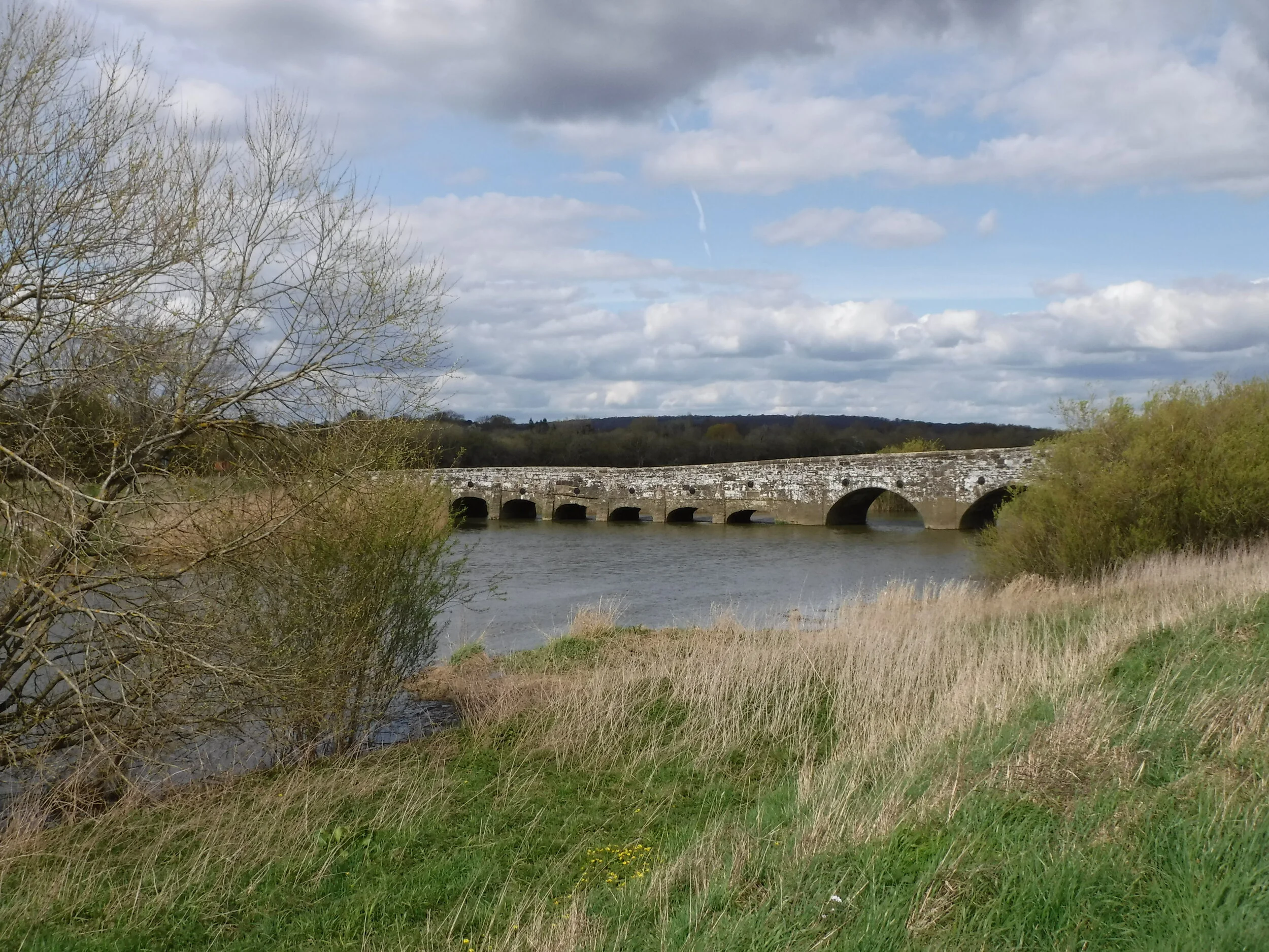
Stay straight ahead as the path dips and then descends to cross the A283 at the point where the road intersects with the River Arun. The original river crossing, Stopham Bridge - an ancient, ironstone structure thought to date from 1422 - is just beyond, and worthy of admiration. Then with the bridge behind you, pass the White Hart pub (if you can bear to bypass its beer garden without pausing for a pint) and follow its access road to the A283, whereupon pass through a gate on the right to reconnect with the Arun. Cross it via the narrow, high-sided footbridge and then continue across a section of floodplain that gets soggy in winter months.
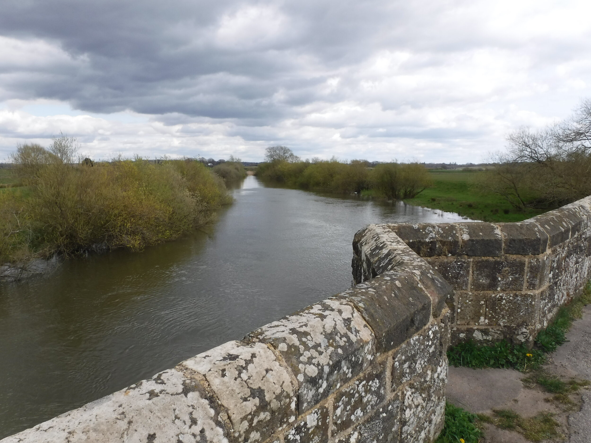
Cross the river again at a pumping station and stay straight ahead on its access track. Just before the level crossing, take the first accessible turn on the right (signposted Wey-South Path) and bear left at the small industrial estate, then right onto a cinder track. Leave this via the first footpath on the left and take the bridge over the railway line to meet the A29. Cross this highway carefully and stay on the Wey-South Path as it traverses the wildlife-rich water meadows that lie on each side, screened by willows. When this finally hits a single-track road, turn left and cross Greatham Bridge - the second of today's historic stone structures, this one from the late 1200s.
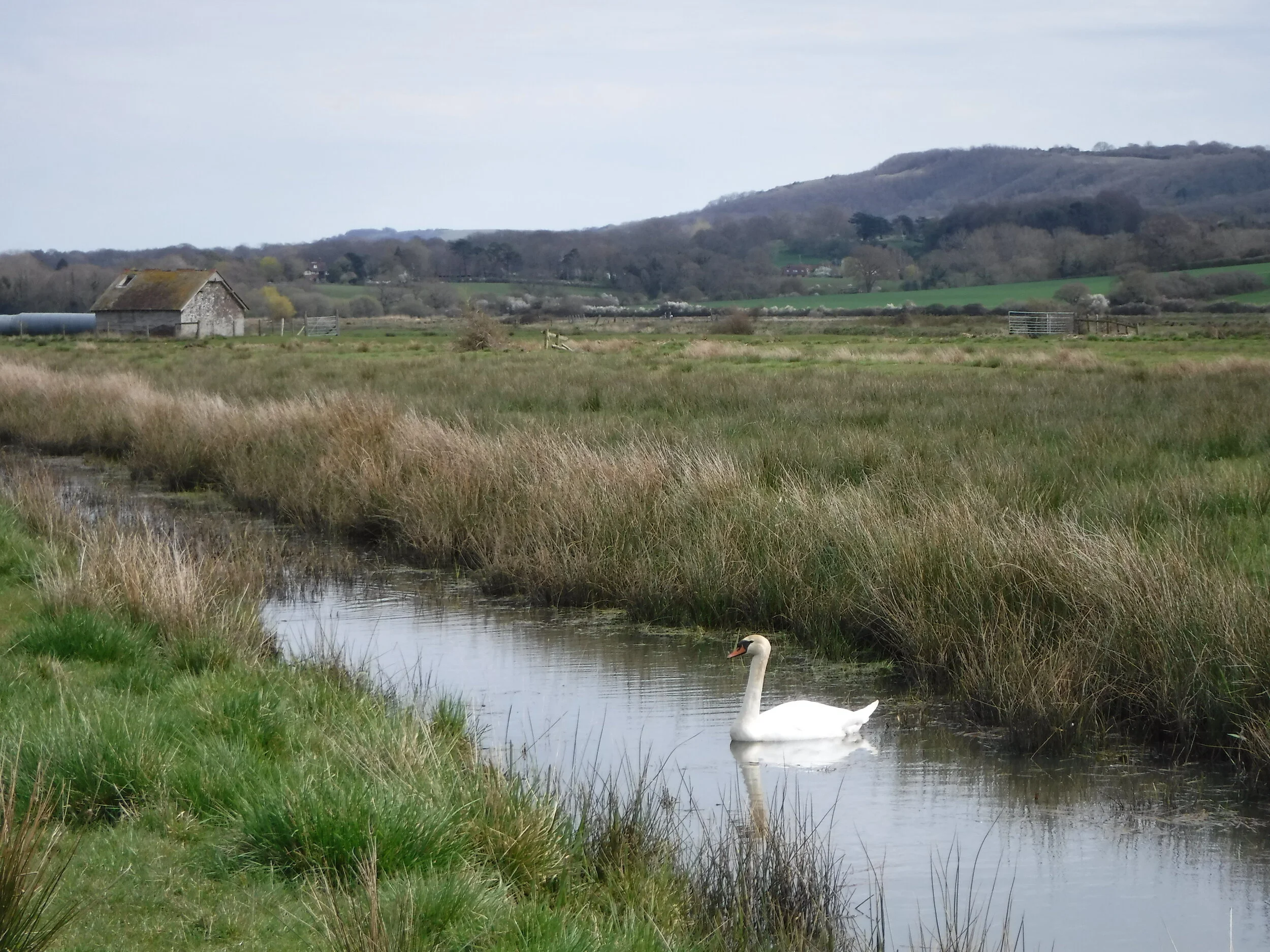
Turn immediately right onto the riverbank until the path bears right on a cinder track that weaves its way along a ridge, through a farmyard and back down to the floodplain, above which rise the glorious South Downs. You're now on Amberley Wildbrooks, an extraordinarily biodiverse area of meadows, marsh and mire that's managed by the RSPB for its bird life. This is where those waterproof boots will prove their worth: parts of the path ahead can range from boggy quagmire (even in summer) to ankle-deep floodwaters in wetter winters. But it's all that water that makes this place so wonderful for wildlife. Look out for deer, ducks, raptors and rarities (hen harriers and great grey shrikes are regular in winter).
The Wey-South Path runs almost dead straight across the marshland before finally rising up again into Amberley, which must surely be a contender for the prettiest village in England. Turn left into the village and claim a table at the Black Horse, whose contemporary update makes a cosy setting for brilliant pub lunches.
Once fully refuelled (and having sunk a pint or two of Amberley's Ale, brewed up the road in Petworth), leave the pub to the left and then take the first right, admiring every picture-perfect cottage and half-timbered house as you go, many of which have thatched roofs and façades draped in colourful wisteria and climbing rose. Follow this lane to the end, past the church and under the walls of Amberley Castle, whose crumbling fortifications have stood for the best part of 900 years.
Continue past the castle and cross the railway line one final time, followed by one last soggy slog across the Arun's floodplain (if it's really sodden, try following the ditch: its raised edge is marginally drier). Then rejoin the river opposite the pointed steeple of Bury's church. Follow the flow downstream to the left as the Arun makes a lazy sweep through its valley. At the footbridge, cross for the penultimate time and follow the curve towards the chalk cliffs ahead, beneath which sits Amberley Station. Prior to getting there, there's one last stone bridge to cross (built in 1875 in the medieval style) before passing under the railway bridge to access the station on your right. If you're not in a rush to catch the next train, round off the day with a pint or two at the Bridge Inn (on the right of the railway overpass) for a final burst of Arun Valley flavour before heading home.
Start planning your journey with www.thetrainline.com