
Ditchling Beacon and Clayton Windmills, East/West Sussex
A country walk on the South Downs: Ditchling Beacon and Clayton Windmills
Old meets even older on this hike to the top of the South Downs and back. The round-trip route criss-crosses the county line between East and West Sussex, in doing so linking a trio of well-preserved, 18th Century windmills and the medieval, half-timbered homes at the heart of the village of Ditchling. Along the way lie top-of-the-world views across the Sussex Weald to the north, with Brighton and the English Channel away in the other direction. Lunch or a pint at The Bull, Ditchling's award-winning gastropub, is the perfect way to celebrate scaling the Downs' steep slopes.
Starting point: Hassocks, East Sussex (one hour from London, 15 minutes from Brighton)
Last hurrah: Hassocks
Distance: 8¾ miles , 4-5 hours
When to go: all year, though the path between Westmeston and Ditchling can get pretty waterlogged in winter.
Difficulty: With both an ascent and descent of the Downs' steep, north-facing flank, this walk is a workout for your legs: but the views from the top are well worth it.


Access this walk here: https://www.outdooractive.com/en/route/hiking-route/wkndr-clayton-windmills-ditchling-beacon/211749572/
You'll need to create an outdooractive profile to view the route, then hit 'Open in App' on your mobile phone to follow it using GPS.
Directions: Exit Hassocks station to the car park. Opposite The Hassocks pub, take the footpath on the right, signposted South Downs. Cross the road at the bottom and turn right, then left on a (often rather muddy) footpath, again signposted South Downs. When this hits an embankment, turn left on a path wedged between woodland and the railway. Where the woodland ends on the left, step over the stile into a meadow. Cross it and bear left to pass a lonely cottage, then turn right onto a farm track. As you round the corner, you'll see the marvellous sight of the South Downs rising abruptly, forming a barrier between here and the coast.
Clearly visible at the crest of the Downs are Clayton Windmills, better known as Jack and Jill. Follow the path in their direction. Cross a road and keep straight ahead on a bridleway, passing a pond to reach Clayton village. Stay on the lane as it curves to the right; then when it meets another lane, turn uphill to the left. At the crest of the rise, leave the lane onto the steep, rough footpath on the right.
Tempting as it might be to take the gentler option at the fork up ahead, keep going uphill to reach open grassland. Aim for the waymarker standing on the skyline, then bear left to keep going uphill. Behind you, the view stretches back towards Hassocks and beyond across the Weald, but you'll probably be too preoccupied by the windmills ahead to give it much notice. Disappointingly, they're hidden from closer inspection by tall hedges, but you can get a decent glimpse of Jill (the white one) by passing through the car park and looking back through the gate. (It's also open to the public on certain days if you time it right.)
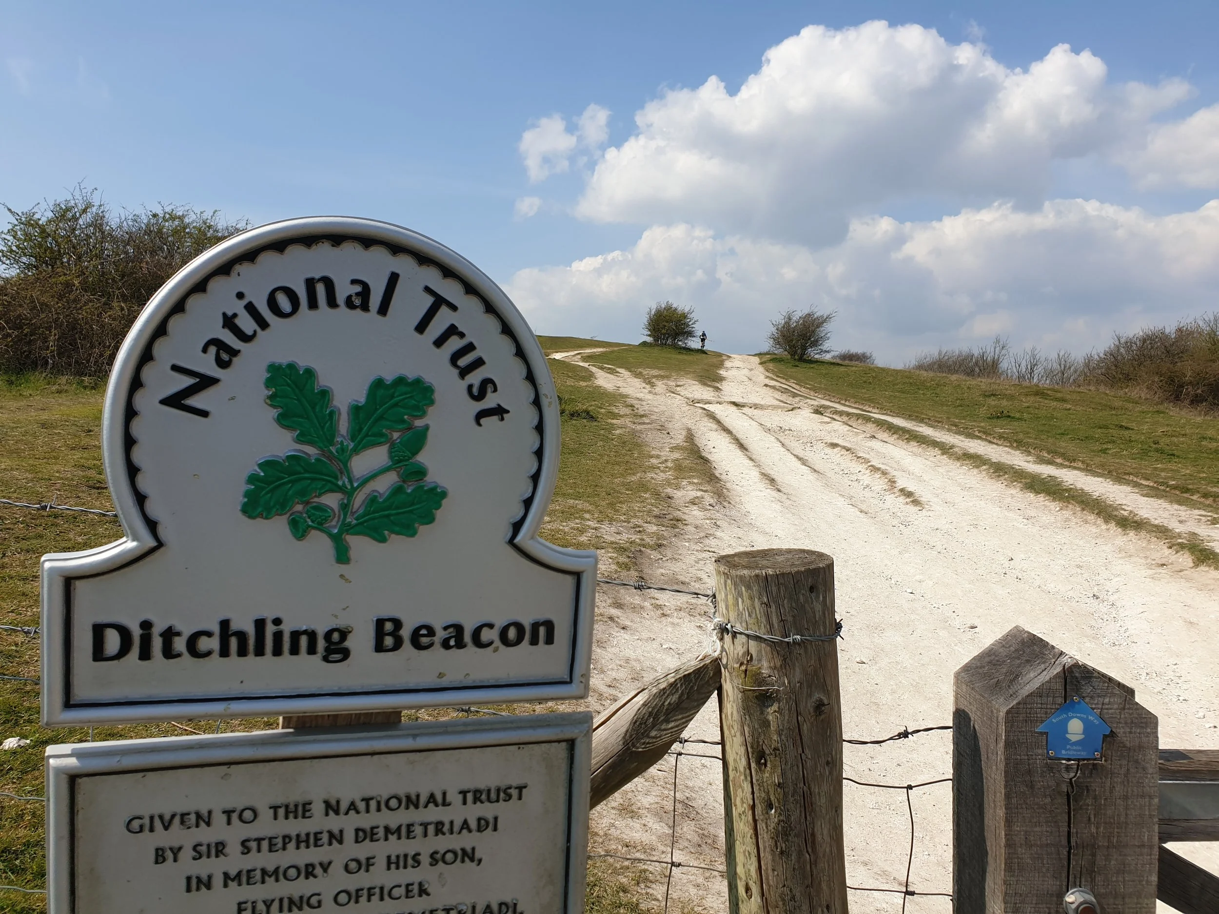
Turn left onto the bridleway to connect with the South Downs Way up ahead. Beyond here, views open up on either side as you ascend: to the left towards the North Downs in Surrey and to the right over Brighton and the sea. Further on, the South Downs Way has an almost edge-of-the-world feel as it runs along the crest of the Downs to Ditchling Beacon: the highest point in East Sussex. With the short-clipped grass peppered with wildflowers and the hills rolling on in the distance, this really is a very special place.
Beyond Ditchling Beacon, the view on a clear day stretches all the way to the Seven Sisters cliffs, where the South Downs end their journey to the sea. When the path dips down to a road, cross it and almost immediately leave the ridge by taking the footpath on the left (over a stile) to descend towards a village. The path here skirts along the edge of an almost vertical drop, which makes for an unusual view looking down to the crowns of the ash trees below. Where this path joins a deeply rutted track at the bottom, turn left and follow this to pretty Westmeston.
At the village, stay straight ahead on the road and take the footpath to the left, signposted Ditchling. This rises above the road before cutting cross-country via paddocks and stunted woodland to reach a housing estate on Ditchling's fringe. Stay on the footpath and pass along the edge of the recreation ground, then turn left onto another path into the village proper. Dating back to Saxon times, its medieval buildings include a property once gifted to Anne of Cleaves by King Henry VIII as part of their divorce. The village has a strong artistic community and played a pivotal role in the 20th Century's Arts and Crafts Movement (it was also the home of the wartime songstress Dame Vera Lynn).
Ahead on the right you'll find The Bull, a 16th Century coaching inn with a modern British menu that reflects local produce and the seasons (with year-round staples including ale-battered fish and chips). Ideally, eat outside on the terrace for its views back towards Ditchling Beacon.
When it's time to move on, go straight at the crossroads to pass the church, then turn right at the war memorial. Where this paved lane ends, continue through the trees on a footpath that parallels the Downs, with Jack and Jill visible on the skyline. The path leads directly to our third and final mill, Oldland Windmill, which dates from 1703 and was restored from dereliction in 2007. The path runs right alongside the mill for fantastic, close-up views
At the end of the lane, turn right and follow the road around the bend, then take the footpath on the left. Stay on this paved track as it bends left into a housing estate, then keep going in this general direction to pick up Woodsland Road, which leads straight back to Hassocks station.
Start planning your journey with www.thetrainline.com